


Banks Vernonia State Trail Offline Map, Oregon app for iPhone and iPad
Developer: Seasonal Spring
First release : 30 May 2015
App size: 12.01 Mb
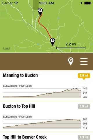
Offline map and trail guide for the Banks Vernonia State Trail in Oregon. Fully interactive map complete with entire trail by segment between official parking areas, GPS location, and elevation profiles.
The Banks–Vernonia State Trail is a paved rail trail and state park in Northwest Oregon. It runs for 21 miles (34 km), primarily north–south, between the towns of Vernonia in Columbia County and Banks in Washington County on an abandoned railroad bed. Banks is about 25 miles (40 km) west of Portland.
Cell phone coverage along the Banks Vernonia State Trail is spotty. Our app solves this problem! Once the map is downloaded, you’re free to explore the entire trail without a network connection and always know exactly where you are.
FEATURES:
• Simple, easy-to-use interface.
• Fully interactive offline map.
• GPS location shown on map.
• Navigate the trail in its entirety.
• Turn trail segments on/off between official parking areas
• Interactive elevation profiles.
• Trail segment lengths.
• Parking locations shown on map.
• Open parking locations in Apple Maps for driving directions
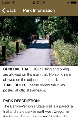
• General park information.
Note: The Banks Vernonia State Trail app is designed for the iPhone. Although it can be installed on GPS-enabled iPads (iPads with Wi-Fi + Cellular), it’s not formatted for the larger iPad screen - it runs doubled like all other iPhone apps.
Proudly made in Banks Oregon by Scott D. Smith. I sincerely hope you like it!